 from Chris
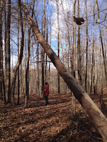
My son and I spent time last weekend doing upgrades to Stevenson Ridge’s trail system—part of a long-range plan we have to do more interpretation of our Civil War sites.
The trails have largely remained unmarked, visible easily enough in the summer and fall, but once the dead leaves start piling up, there are places where the trails vanish entirely, lost beneath a blanket of crispy brown leaf-fall.
Courtesy of a couple cans of spray paint, we now have a red trail and a blue trail. Each trail forms a loop, and they’re connected at the far end to form an even larger loop.
The red trail departs from the edge of the pond between the Log Home and the Riddick House. It parallels the stream that drains from the pond and goes along the western edge of our property. There, it passes a dramatic set of earthworks that climb the steep hillside in the far side of the stream.
While the stream goes on to drain into the Ni River wetlands, the red trail rises to higher ground and then circles back toward the main property. On its way, it passes through more earthworks and past some covered ways (dug-out pathways that offered protection to soldiers carrying supplies to the front). Along the way, it also passes the site in the woods where Jenny and I got married!
The blue trail begins as the gravel road that runs past the Tobacco Barn and Adrian Cabin; once in the woods, it transforms into the path. In that same area, a line of earthworks rises up from the forest floor next to the trail. The trail then T’s. To the right, it follows a historic roadbed, then veers northwards, past an extensive system of covered ways and supply bunkers, all the way to the far tip of the property’s earthworks. There, on the edge of a precipice, the trail overlooks the Ni River wetlands. The earthworks there are incredible! The blue trail then loops back toward the main property, paralleling the earthworks for part of the way.
 Along that far edge of the property, a spur connects the far tip of the blue trail with the far tip of the red trail, allowing visitors to make a giant loop if they desire.
Along both trails, spots of interest are marked with a double swatch of color. This winter, I’ll develop a trail guide that will explain what’s at each of the locations. The guide will include a map that also lays out the distances of each leg of the trail system.
Even without a trail guide, though, it’s always refreshing and relaxing to take a walk through the woods. We have a total of 87 acres, so there’s much to explore. Next spring, we’ll have two more short spurs to open that will show off even more of our unique connection to the Civil War.